
01
Photogrammetry
From drone and camera imagery we compute precise 3D geometry and textures — ideal for facades, roofs and outdoor areas.
Delivers
3D mesh · orthophoto · point cloud
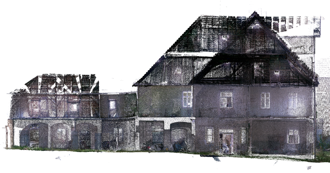
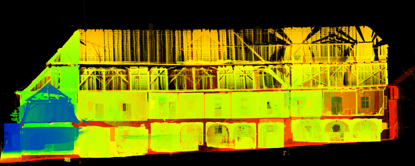
A walkable 1:1 replica for owners & managers — point cloud, panorama, web viewer.
We are architects in Berlin — experts in BIM, digital twins and digital as-built capture. With drone, laser scan and Gaussian Splatting we make your building capturable, explorable and workable, online and off.
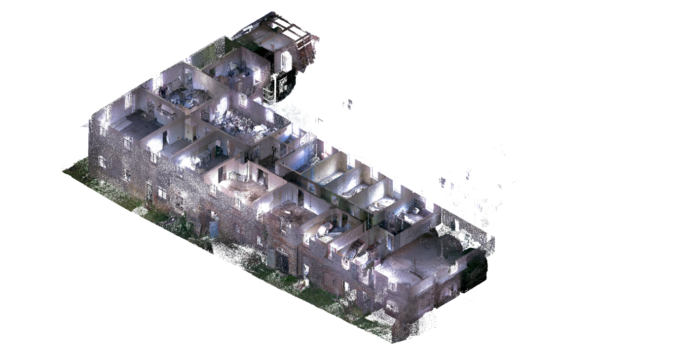
Walkable point cloud — interactive in the browser.
From capture to finished drawing — all from one source.
From drone and camera imagery we compute precise 3D geometry and textures — ideal for facades, roofs and outdoor areas.
A true-to-scale, walkable replica of your building. Point cloud, panorama and model combined.
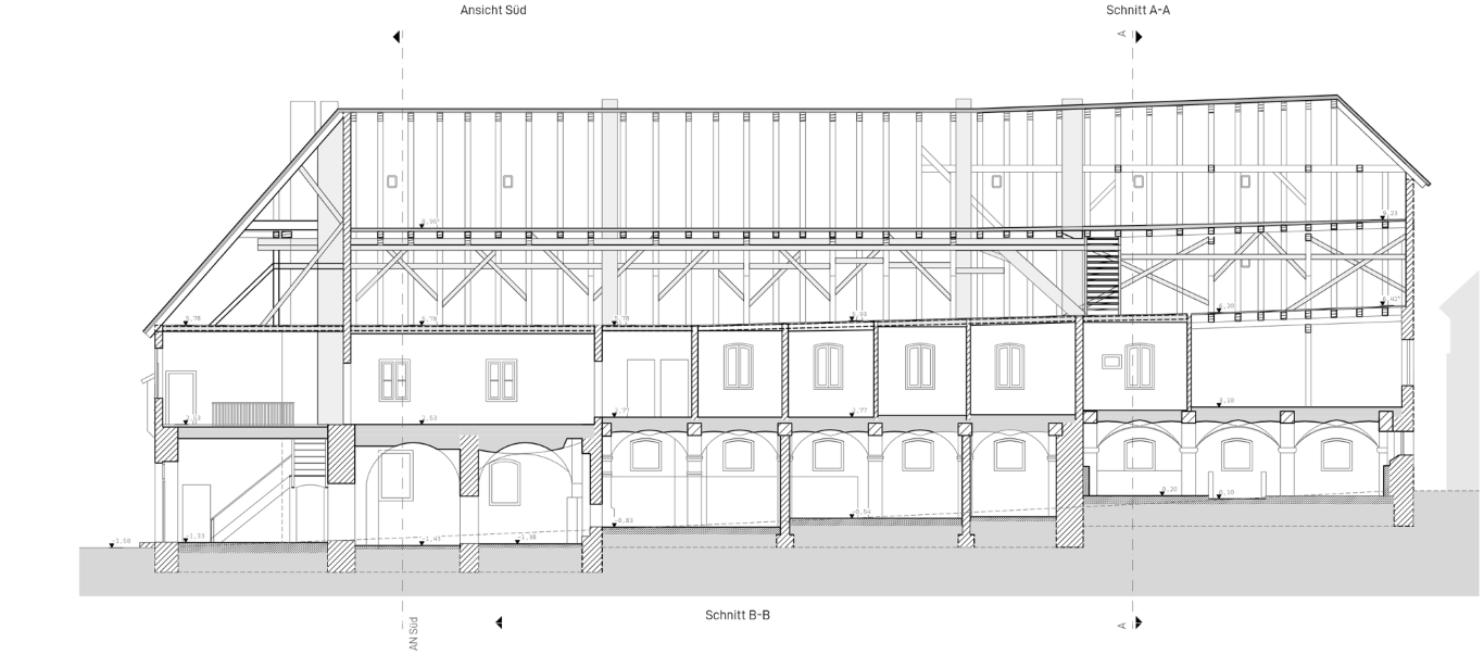
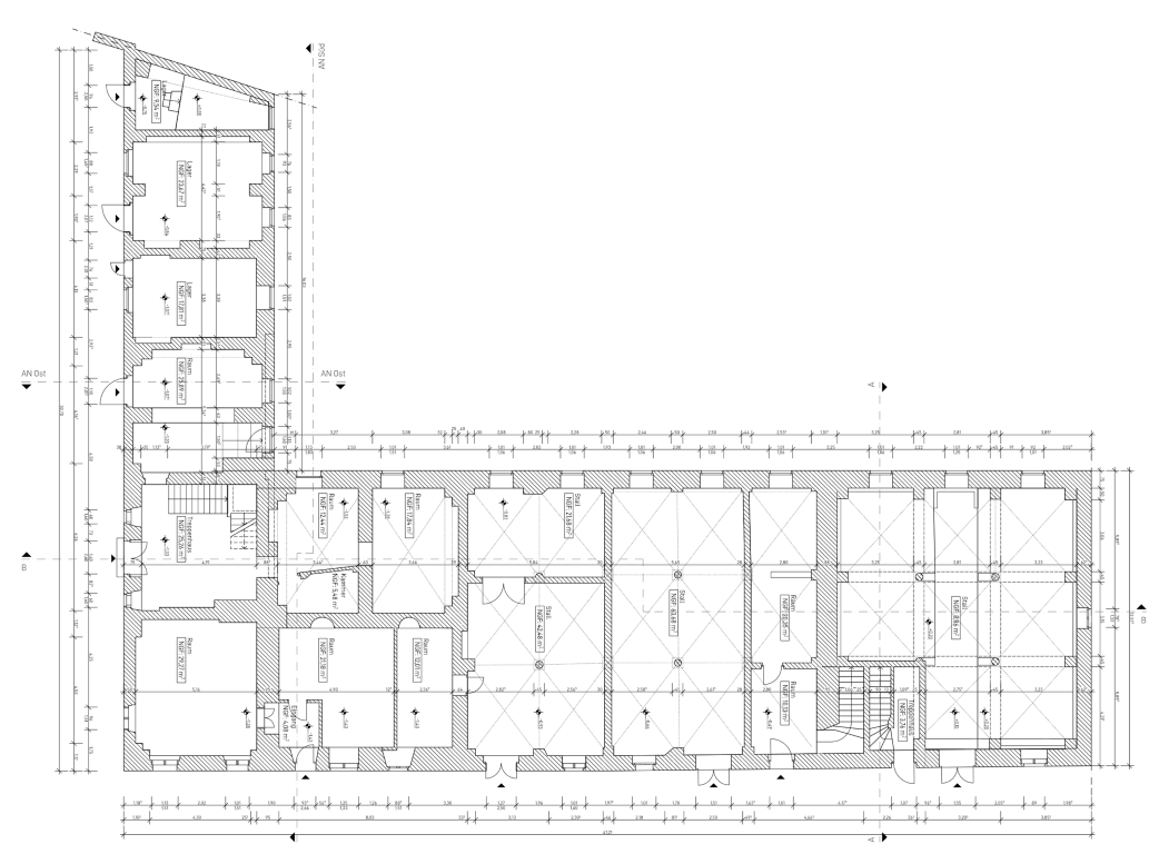
Existing buildings and new builds as a precise LOD300 3D model — the basis for design, retrofit and permits.
OpenBIM in ArchiCAD and IFC — structured, attributed and handover-ready for your office.
Scaled 2D drawings from the model: site plan, floor plans, elevations and sections — plot-ready in your office standard.
Photorealistic, walkable 3D scenes from photos — interactive in the browser, no software needed.
Address, area, plans / photos uploaded — we reply with a binding quote and a slot.
We at amsel are a small team of architects in Berlin. We are united by a passion for historic and modern architecture — and our boundless curiosity.
We are experts in BIM, digital twins and digital as-built capture. We build 3D models from drone surveys (photogrammetry) and 3D laser scans (SLAM & terrestrial), and create immersive in-browser experiences with Gaussian Splatting, digital walk-throughs and viewers — and we genuinely enjoy it.
We also develop software and tools for your workflows and ours — so your building becomes capturable, explorable and workable, online and off.
We are open-source and openBIM enthusiasts and prefer working with established tools and industry standards. We use AI tools and LLMs deliberately and proficiently — for preparing data, for development and for faster results. We take data protection seriously and work exclusively in line with the GDPR (DSGVO).
As architects, it goes without saying that we also offer design services, area calculations (DIN 277, MF-GIF, living areas per WoFlV), Abgeschlossenheit applications and architectural concepts — always state of the art and in line with current standards, guidelines and regulations.
And if we ever reach our own limits, we draw on a large, reliable network of urban planners, architects, designers, (software) developers and many more experts.
We would love to hear from you and spread our wings together. Drop us a line today!
Preparation, resident notice, communication — straight from the browser.
How to prepare your property for the LiDAR scan. Printable, free.
Open checklistResident notice as PDF — generated and printed live in the browser.
Create notice